

Site Designed, administered and published by Anthony Green

Loading...
Location
This walk begins at the western extremity of the Arrow Valley Park.
There is a large Car Park (use Google Map below) at the entrance of Needle Mill Lane, which is close by the Alvechurch Highway (A441).
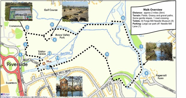
This 2 mile (approx) walk follows grassy and gravel paths and includes the Bordesley Abbey Ruins, a pleasant walk along the River Arrow and the National Needle Museum at Forge Mill. There are some gentle slopes. There are toilets and a seasonal cafe at Forge Mill.
In wet conditions the grass paths can be muddy and suitable footwear is recommended under these conditions.
Please click on this map to download the trifold A4 map.
This is in pdf format and can be printed using Adobe Reader or similar.